Introduction
The Dholera Special Investment Region (SIR) master plan is one of India’s most ambitious urban development projects. Covering 920 square kilometers, this comprehensive plan transforms a rural area into a world-class smart city. Understanding the master plan helps investors, businesses, and residents make informed decisions about this growing urban center.
The master plan divides the entire area into different zones and sectors, each serving specific purposes. Development happens in carefully planned phases to ensure proper infrastructure and sustainable growth.
Overview of Dholera SIR
Total Area and Scale
Dholera SIR spans 920 square kilometers, making it larger than Singapore (720 sq km) and nearly the size of Hong Kong (1,100 sq km). This massive area includes parts of Dholera, Navagam, Khuntavada, Mithi Virdi, and surrounding villages.
The scale allows for comprehensive planning where residential, commercial, industrial, and recreational areas are designed together from the beginning, rather than growing organically over time.
Strategic Location
Located on the Gulf of Khambhat coast in Ahmedabad district, Dholera sits at the intersection of major economic corridors:
- Delhi-Mumbai Industrial Corridor (DMIC)
- Western Dedicated Freight Corridor
- Ahmedabad-Dholera Investment Region
This positioning makes it ideal for manufacturing, logistics, and international trade.
Master Plan Framework
Planning Principles
The master plan follows international best practices for smart city development:
Compact Development: High-density, mixed-use development reduces urban sprawl and makes infrastructure more efficient.
Transit-Oriented Development: Residential and commercial areas are planned around transportation hubs like metro stations and bus stops.
Sustainable Design: Green spaces, renewable energy, and environmental protection are integrated throughout the plan.
Economic Zones: Different areas are designated for specific economic activities to create specialized clusters.
Development Timeline
The master plan spans 30 years (2009-2040) with development happening in multiple phases:
- Phase 1: 2009-2019 (Infrastructure foundation)
- Phase 2: 2019-2029 (Major development and population growth)
- Phase 3: 2029-2040 (Completion and maturation)
Zoning Structure
Primary Zones
The master plan divides Dholera SIR into six primary zones, each with specific functions:
Zone 1 – Activation Area (Phase 1)
- Area: 22.5 square kilometers
- Focus: Initial infrastructure and early development
- Status: Under active development
- Key features: Administrative center, residential complexes, basic industries
Zone 2 – Industrial Expansion
- Area: 150 square kilometers
- Focus: Heavy and medium industries
- Industries: Automotive, chemicals, textiles, engineering
- Infrastructure: Dedicated power supply, effluent treatment, cargo facilities
Zone 3 – Logistics and Warehousing
- Area: 180 square kilometers
- Focus: Storage, distribution, and transportation
- Features: Large warehouses, truck terminals, rail connectivity
- Advantages: Access to highways, railways, and planned airport
Zone 4 – Knowledge and Innovation
- Area: 120 square kilometers
- Focus: IT, research and development, education
- Facilities: IT parks, universities, research centers
- Target: Technology companies and skilled professionals
Zone 5 – Residential and Commercial
- Area: 200 square kilometers
- Focus: Housing, retail, entertainment, services
- Types: Affordable housing, premium residences, shopping centers
- Amenities: Schools, hospitals, parks, sports facilities
Zone 6 – Green and Recreation
- Area: 267.5 square kilometers
- Focus: Parks, forests, water bodies, agriculture
- Purpose: Environmental protection, recreation, food production
- Features: Central park, sports complexes, eco-tourism areas
Mixed-Use Development
While zones have primary functions, the master plan encourages mixed-use development within each zone. This means residential areas include local shops and services, while industrial areas have worker housing and commercial facilities.
Sector-Wise Breakdown
Industrial Sectors
Heavy Industries Sector
- Location: Eastern part of Zone 2
- Area: 80 square kilometers
- Industries: Steel, petrochemicals, power generation
- Infrastructure: Heavy-duty roads, rail sidings, large power substations
Medium Industries Sector
- Location: Western part of Zone 2
- Area: 70 square kilometers
- Industries: Automotive parts, machinery, textiles
- Features: Standard factory plots, shared facilities, common effluent treatment
Light Industries and IT Sector
- Location: Zone 4 and parts of Zone 1
- Area: 50 square kilometers
- Industries: Electronics, software, biotechnology, food processing
- Facilities: Plug-and-play factories, IT parks, incubation centers
Residential Sectors
Affordable Housing Sector
- Location: Eastern Zone 5
- Area: 60 square kilometers
- Target: Middle and lower-income groups
- Features: Apartments, row houses, basic amenities
- Price range: Budget-friendly options for workers and employees
Premium Residential Sector
- Location: Western Zone 5, near coast
- Area: 80 square kilometers
- Target: High-income professionals and executives
- Features: Villas, gated communities, luxury amenities
- Price range: High-end properties with premium features
Integrated Townships
- Location: Throughout Zone 5
- Area: 60 square kilometers
- Features: Self-contained communities with housing, schools, hospitals, shopping
- Target: Families seeking complete lifestyle solutions
Commercial Sectors
Central Business District (CBD)
- Location: Center of Zone 1
- Area: 5 square kilometers
- Features: Office towers, banks, government offices, hotels
- Purpose: Administrative and business hub for the entire SIR
Retail and Entertainment Sector
- Location: Zone 5, integrated with residential areas
- Area: 20 square kilometers
- Features: Shopping malls, restaurants, cinemas, entertainment centers
- Design: Pedestrian-friendly areas with parks and open spaces
Logistics and Trade Sector
- Location: Zone 3, near expressway and railway
- Area: 180 square kilometers
- Features: Cargo terminals, customs facilities, trade centers
- Purpose: Support import-export and domestic trade
Development Phases Explained
Phase 1 (2009-2019): Foundation Building
Primary Focus: Basic infrastructure development in the 22.5 sq km activation area
Key Achievements:
- Road network construction
- Power transmission lines
- Water supply systems
- Sewage treatment plants
- Administrative buildings
- Early residential and industrial developments
Investment: Over ₹15,000 crores in infrastructure Population Target: 50,000 residents Jobs Created: 25,000 positions
Phase 2 (2019-2029): Major Expansion
Primary Focus: Large-scale development across multiple zones
Planned Developments:
- Dholera International Airport completion
- Major industrial establishments
- Residential townships
- Educational institutions
- Healthcare facilities
- Metro rail connectivity
Investment Target: ₹50,000 crores Population Target: 300,000 residents Jobs Target: 150,000 positions
Key Projects:
- Bullet train station
- University campuses
- Specialty hospitals
- Major manufacturing plants
Phase 3 (2029-2040): Completion and Maturation
Primary Focus: Final development phases and city optimization
Planned Activities:
- Completion of all zones
- Advanced transportation systems
- Smart city technology implementation
- Tourism and recreational facilities
- International business centers
Investment Target: ₹75,000 crores Population Target: 2 million residents Jobs Target: 1 million positions
Infrastructure Planning
Transportation Infrastructure
Road Network
- 6-lane highways connecting to major cities
- 4-lane roads within industrial areas
- 2-lane roads in residential areas
- Separate lanes for pedestrians and cyclists
Railway Connectivity
- High-speed rail (bullet train) station
- Dedicated freight corridors
- Local metro rail system
- Integration with national railway network
Aviation
- Dholera International Airport
- Cargo facilities for international trade
- Private aircraft facilities
- Helicopter landing pads for emergency services
Utility Infrastructure
Power Supply
- Multiple power sources including coal, gas, solar, and wind
- Dedicated substations for industrial areas
- Smart grid technology for efficient distribution
- Backup power systems for critical facilities
Water Management
- Desalination plants for fresh water supply
- Rainwater harvesting systems
- Wastewater treatment and recycling
- Storm water drainage systems
Telecommunications
- High-speed fiber optic network
- 5G mobile connectivity
- Smart city control centers
- Emergency communication systems
Land Use Allocation
Sector-wise Land Distribution
Industrial Use: 35% (322 square kilometers)
- Heavy industries: 15%
- Medium industries: 12%
- Light industries and IT: 8%
Residential Use: 25% (230 square kilometers)
- Affordable housing: 10%
- Premium housing: 8%
- Integrated townships: 7%
Commercial and Services: 10% (92 square kilometers)
- Business districts: 4%
- Retail and entertainment: 3%
- Logistics and warehousing: 3%
Infrastructure and Transportation: 15% (138 square kilometers)
- Roads and highways: 8%
- Railway and metro: 4%
- Airport and aviation: 3%
Green Spaces and Recreation: 15% (138 square kilometers)
- Parks and gardens: 8%
- Sports facilities: 4%
- Natural reserves: 3%
Plot Sizes and Availability
Industrial Plots
- Small plots: 0.5-2 acres for light industries
- Medium plots: 2-10 acres for medium industries
- Large plots: 10-100 acres for heavy industries
- Mega plots: 100+ acres for large corporations
Residential Plots
- Individual plots: 100-500 square meters
- Builder plots: 1-5 acres for apartment projects
- Township plots: 10-50 acres for integrated developments
Commercial Plots
- Retail plots: 50-200 square meters
- Office plots: 200-2000 square meters
- Mall and entertainment plots: 1-10 acres
Regulatory Framework
Development Controls
Building Height Restrictions
- Residential areas: Maximum 15 floors
- Commercial areas: Maximum 30 floors
- Industrial areas: As per specific requirements
- Airport vicinity: Height restrictions as per aviation norms
Density Controls
- Residential density: 150-300 persons per hectare
- Commercial density: As per floor space index (FSI) norms
- Industrial density: Based on pollution and safety requirements
Setback Requirements
- Minimum distances from roads, boundaries, and other buildings
- Green belt requirements around industries
- Buffer zones between different land uses
Approval Processes
Single Window Clearance
- All approvals through one government office
- Reduced paperwork and processing time
- Online application and tracking systems
- Time-bound approvals with penalty for delays
Environmental Clearances
- Environmental impact assessments for major projects
- Pollution control measures mandatory
- Regular monitoring and compliance checks
- Penalties for environmental violations
Investment Opportunities by Sector
High-Potential Sectors
Manufacturing
- Automotive and auto components
- Chemicals and petrochemicals
- Textiles and garments
- Food processing and agro-industries
- Electronics and electrical equipment
Services
- Information technology and software
- Financial services and banking
- Logistics and supply chain
- Healthcare and medical services
- Education and training
Infrastructure
- Power generation and distribution
- Water supply and treatment
- Waste management and recycling
- Transportation and mobility
- Telecommunications and internet
Government Incentives
Tax Benefits
- Corporate tax exemptions for initial years
- Accelerated depreciation allowances
- Exemption from certain state taxes
- Reduced stamp duty on land purchases
Financial Support
- Subsidized loans for specific industries
- Government co-investment in large projects
- Export promotion incentives
- Research and development grants
Challenges and Solutions
Infrastructure Coordination
Challenge: Coordinating multiple infrastructure projects across different zones Solution: Integrated project management office overseeing all developments
Environmental Protection
Challenge: Balancing development with environmental conservation Solution: Strict environmental norms and regular monitoring systems
Skilled Workforce
Challenge: Ensuring availability of skilled workers for various industries Solution: Educational institutions and training centers within the SIR
Connectivity
Challenge: Connecting the large area with efficient transportation Solution: Multi-modal transportation system with roads, rail, and air connectivity
Future Outlook
2025-2030 Expectations
- Major industrial establishments operational
- Significant population growth and urbanization
- International airport fully functional
- Metro rail and bullet train connectivity
- Emergence as major logistics and manufacturing hub
Long-term Vision (2030-2040)
- Complete development of all zones
- Population of 2 million residents
- 1 million jobs across various sectors
- International recognition as model smart city
- Major contributor to Gujarat and India’s economy
Conclusion
The Dholera SIR master plan represents a comprehensive approach to creating a modern, sustainable, and economically vibrant city. The systematic zoning, phased development, and integrated infrastructure planning ensure that the city grows in an organized manner while providing opportunities for various stakeholders.
Understanding this master plan is crucial for anyone considering investment, relocation, or business establishment in Dholera. The clear allocation of land uses, development phases, and regulatory framework provides certainty and transparency for all participants in this urban transformation.
As Dholera continues to develop according to this master plan, it will serve as a model for other smart city projects in India and demonstrate how strategic planning can create prosperous and sustainable urban centers.

 10Jul
10Jul 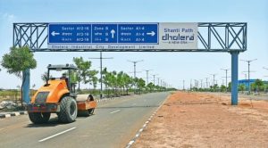 11Jul
11Jul